This is a project to overlay the information from the 1846 Rimington Tithe award information collected and researched by Brian Stott on to modern maps using QGIS software.
For more details on the Rimington Tithe award CLICK HERE.
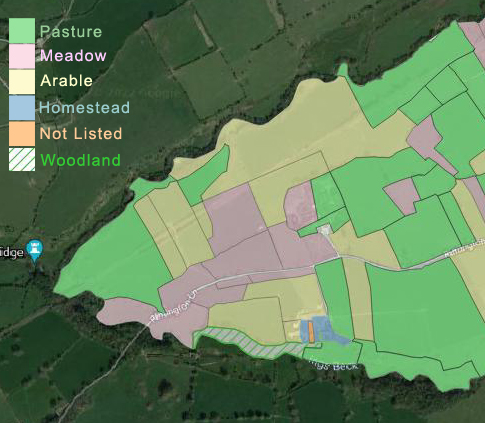
You can see this information by going to:-
Rimington Tithe Award Maps Google KML files these show the field names and the land use recorded in the 1846 award.
To add to your Google Earth Pro, download the files, in Google Earth go to File then Open browse for the downloaded files and then Open.
Field Names rimington-tithe-field-names.kml
Field Numbers rimington-tithe-field-numbers.kml
Arable rimington-tithe-arable.kml
Arable and Pasture rimington-tithe-arable-and-pasture.kml
Meadow rimington-tithe-meadow.kml
Pasture rimington-tithe-pasture.kml
Woodland and Plantation rimington-tithe-woodland.kml
Homesteads rimington-tithe-homestead.kml
Mines rimington-tithe-mines.kml
Lanes and Roads rimington-tithe-lanes-and-roads.kml
Landuse not listed rimington-tithe-not-listed.kml